Location
Lake Ginninderra is located on the Ginninderra Creek adjacent to the Belconnen Town Centre.
The lake's water is comprised of stormwater discharge from urban and rural areas. It has a catchment of 9,800 hectares, including Gungahlin and eastern Belconnen.
Description of facilities
Lake Ginninderra was originally designed as a setting for the Town Centre and a recreation and landscape feature for the Belconnen community. The natural character of the lake, its foreshores and associated conservation values are greatly valued by the community.
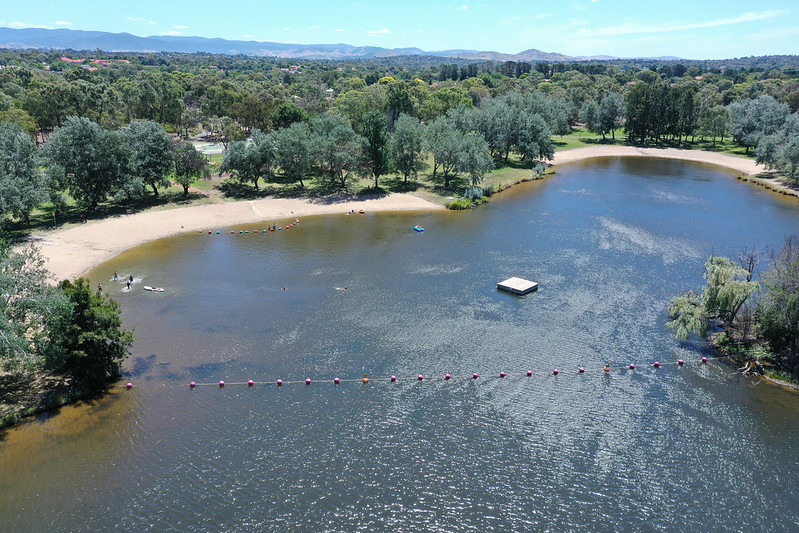
The lake is also a popular recreation facility. It is a great place for swimming, canoeing, sailing, fishing and walking.
Lake Ginninderra was established in 1974 with the construction of the Ginninderra Drive embankment over Ginninderra Creek. It has a surface area of 105 hectares and an average depth of 3.5 metres. The lake is U-shaped, forming an extensive central peninsula.
The lake's eastern arm comprises the inflow of Ginninderra Creek, from Giralang down past the naval station to the southern tip of the peninsula. This area comprises extensive wetland and bird habitat for much of its length.
Swimming areas, toilets and barbecue and picnic areas are located:
- Downstream of the Ginninderra Drive bridge on the eastern arm
- Macdermott Place on the north western side of the lake.
Boat ramps are located at:
- Macdermott Place on the north western side
- Diddams Close on the north eastern side.
John Knight Memorial Park is located on the south eastern side of the lake. The park connects to the lake by way of vistas, an island and walkways.
A cycleway and walkway have been constructed around the full periphery of the lake. This links with the Belconnen cycleway network at a number of locations.
Stormwater control
The lake is an important stormwater retention facility. It links the Giralang, Gungahlin, Eastern Valley Way and Benjamin Way drains or waterways to the lower part of Ginninderra Creek.
It is possible for lake water to be used for irrigation of the John Knight Memorial Park area.
A gross pollutant trap (GPT) and small pond are located on the northern inlet end. They provide an important facility for intercepting and limiting litter discharged from the lake. They are also an extension of the wetland habitat zone.
The Eastern Valley Way GPT and wetlands at the southern end of the lake similarly serve to intercept significant amounts of litter discharged from the Eastern Valley Way drain.
Potential hazards
Elevated water flow velocities in the vicinity of the Ginninderra Drive spillway at times of heavy rainfall are a potential safety hazard. We have installed fences and a floating boom to exclude the public from this area.
Given their urban runoff water source, from time to time, urban lakes may be subject to health hazards such as toxic blue-green algal blooms or high faecal bacteria counts. Health and environmental agencies monitor the water quality of the lakes. They issue public health warnings in the event of toxic blue-green algae or faecal bacteria representing a potential risk to health.
Lake edges are gently graded along areas of deep water to avoid sudden drops. The exceptions are the formal masonry walls adjacent to the Town Centre/Emu Bank area, and the police jetty.
Graded edges also minimise the potential for the lake to become a local mosquito nuisance.